A steel-hulled trawler is currently dragging its nets through waters that, at least in theory, belong to a marine protected area somewhere in the South Pacific. The automatic identification transponder was turned off by its captain several hours ago. The location of the ship is unknown to the port authorities. There isn’t a Coast Guard cutter nearby to step in. However, a radar pulse was just reflected off the ship’s hull by a satellite flying overhead at a height of about 500 miles, and a data center algorithm detected the contact. As it happens, the vessel is not invisible.
Illegal fishing has existed in a sort of regulatory limbo for decades. According to widely cited estimates, about a fifth of the world’s seafood catch is harvested illegally, and governments have been unable to take significant action because the oceans are too big, too dark, and too poorly monitored. Every year, industrial fleets with almost 500,000 vessels transport about 100 million metric tons of fish. Currently, over one-third of commercial species are overfished beyond what is necessary for reproduction. The enforcement situation was dire for a while, and the numbers are astounding.
Synthetic aperture radar combined with machine learning is changing the game, albeit slowly. By layering radar detections over traditional tracking data, organizations like Global Fishing Watch have created digital maps that show fleets that were previously invisible. Every few seconds, ships must broadcast their position using the traditional AIS system. It was not intended to police fishing grounds, but rather to prevent collisions. Early on, illicit harvesting captains realized this and turned off their transponders. About 75% of vessels detected by synthetic aperture radar were not sending any AIS signal at all, according to research on coastal waters. It’s worth stopping to consider that number. Three of every four ships that were picked up by radar had essentially vanished.
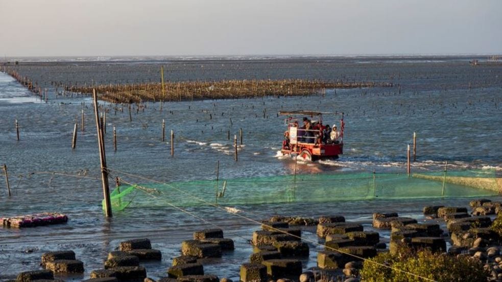
The effects spread in ways that aren’t always clear from a headline. Although over 8% of the world’s oceans are now marine protected areas, only about 3% of them actually forbid industrial fishing. Bottom trawling, one of the most environmentally damaging commercial fishing techniques, is still allowed in many “protected” zones. Countries have committed to protecting 30% of the ocean by 2030, which may seem like a lofty goal until you consider how inadequate the current protection is. Satellite monitoring may end up being the distinguishing factor between political theater and true conservation.
In July 2025, two studies that were published in Science provided cautious encouragement. AIS tracking, radar imagery, and the actual legal regulations governing nearly 1,400 marine protected areas covering approximately three million square miles were all combined by researchers. The conclusion is that poachers are mostly kept out of areas where industrial fishing is expressly and completely prohibited. That distinction is important. Bans that are supported by unambiguous legal teeth—that is, complete prohibition enforced with actual consequences rather than aspirational guidelines or partial restrictions—are the ones that are effective. There’s a feeling that technology is at last providing regulators with the proof they require to distinguish between the paper promises and the real commitments.
However, limitations still exist, and to act otherwise would be naive. Small boats, such as those found in Southeast Asia and West Africa, where artisanal and semi-industrial fleets blur legal boundaries, are difficult for synthetic aperture radar to detect. There are gaps in satellite revisit times. Many developing countries lack the funding and processing capacity needed to handle the massive amount of imagery. Furthermore, there is still a lack of political will to address the findings. In 2017, a Chinese ship carrying 300 tons of marine life—including 6,000 dead sharks—was discovered inside the Galápagos Marine Reserve. The crew was fined heavily and sentenced to prison. However, as that case developed, it was difficult to ignore how many similar hauls in less well-known waters go entirely unreported.
The trajectory feels different now. The instruments are becoming more acute. The cost of satellite data is decreasing, radar coverage is growing, and machine-learning models are becoming more adept at differentiating fishing patterns from cargo transit. In order to create a sort of forensic archive of ocean activity, Global Fishing Watch and researchers at universities like the University of Wisconsin are constructing datasets that were nonexistent five years ago. Questions concerning sovereignty, enforcement capabilities, and the ultimate beneficiaries of the catch are raised by the fact that nations that previously had no way to confirm what was happening in their own exclusive economic zones can now see it mapped in almost real time.
The ocean is still vast and, for the most part, still dark. However, the days of complete anonymity at sea are coming to an end. What governments decide to do with the mounting evidence above them will determine whether that results in healthier fisheries or simply a better-documented decline.